 A topographical survey provides an accurate laser-measured plan of a site and its surroundings which is detailed to show all natural and man-made features, exact levels and boundary locations. This includes all trees & vegetation, services and manholes, and distances to adjacent properties for example.
The digital plans produced by a topographical surveyor can then be used by architects like ourselves, engineers and building contractors to provide accurate design proposals that we can be confident can be accommodated on the site in terms of size, ground and floor levels for access, heights and appropriate relationships with neighbouring properties and other features.
What is surveyed in a topographical survey?
A topographical survey can vary, dependent on the requirements of the client and constraints of the site. Elements that may be part of the survey can include:
- Site boundaries
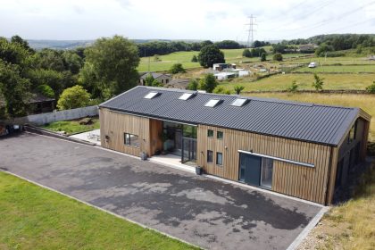
- Buildings and structures
- Adjacent highways, footpaths and driveways
- Street furniture including lamp posts, bus stops & post boxes
- Trees, hedges and vegetation
- Water features such as streams or ponds
- Ground levels, contours and changes in surfaces
- Drainage gullies and manholes (including cover and invert levels)
- Overhead cables and nearby pylons
- Features, buildings and levels adjacent to the site
How is a topographical survey carried out?
The process typically includes the use of GPS equipment that will survey the area which will laser scan the area to detail the features of the site. This is then used to produce CAD drawings which includes site measurements and fully-scaled 3D drawings to give the users a fully-detailed oversight of the site features.
Why do I need a topographical survey?
It is very important to get accurate information about your site from the outset and a topographical survey will provide this, meaning you don’t get any surprises further down the line which could prevent design proposals being properly implemented and leading to costly design changes and delays.
For this reason we will almost always recommend that a digital topographical survey is carried out on a site at the outset to avoid any such problems later on in the project.
What about a measured building survey?
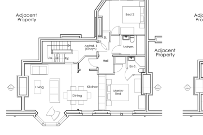
We often also recommend that a measured building survey is carried out at the same time as a topographical survey, especially if the proposals include alterations and extensions to an existing building.
This provides detailed and accurate floor plans, elevations and sections of the existing building, as well as heights and levels again to ensure proposals can be accurately accommodated and implemented. This is with reference to exact room sizes, ceilings and floor-to-floor heights, bulkheads, fireplaces and chimneys, staircases, roof spaces and basements for example.
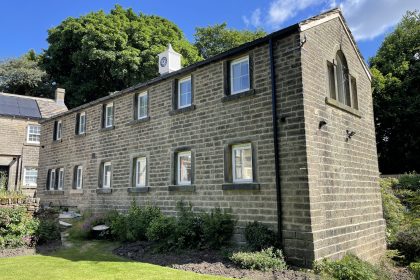
A fully measured building survey is also especially important if the building is close to other adjacent buildings, if it is a Listed Building or in a conservation area.
How do I find a specialist?
We have extensive experience of working with topographical and measured building surveyors and are happy to advise and recommend providers and identify the specific requirements of the survey for your particular project.
Do get in touch if you would like to discuss your planned project, we would be more than happy to help.